Dagestan
From the Caucasus to the Caspian
The mountainous Republic of Dagestan lies at the eastern reaches of Russia’s North Caucasus region on the Caspian Sea coast. Sandwiched between Chechnya to the west and Azerbaijan and Georgia to the south, this relatively little-known corner of the world offers the visitor stunning scenery, a wealth of history and some remarkably good wines.
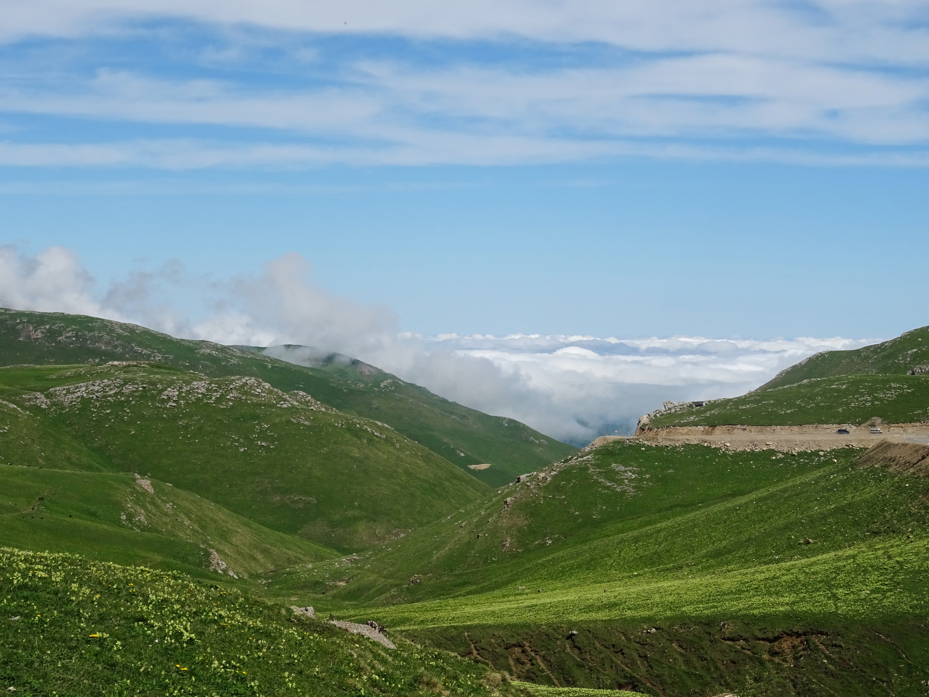
Its highest peak, Bazardyuzyu, towers almost four and a half kilometres above sea level, while at the shores of the Caspian the centuries-old fortifications at Derbent are testimony to Dagestan’s position at the crossroads of successive civilisations.
Earlier this year, I visited Dagestan as part of a trip to four republics of the North Caucasus.
There is very little literature about the place and no guide books in any language I can read (my Russian is rudimentary). The only publication I could find that was not overtly political was a rather dense academic study, which I did my best to plough through. Normally, I like to research a place before I visit it, but I arrived in Dagestan knowing very little about it at all.
Click on the images to enlarge them and see the captions:


Although it has fewer than three million inhabitants, Dagestan is home to several dozen ethnic groups, including Avars, Dargins, Kumyks, Laks, Azerbaijanis, and Chechens, making it Russia’s most ethnically diverse republic.
Dagestan has 13 official languages, as well as Arabic, Turkish, Persian, Armenian and Georgian, which are considered unofficial languages. Its mountainous terrain means that, until relatively recently, various ethnic groups and clans living high up or in isolated valleys had little contact with the outside world.
Each group has its own language, which their isolation has helped keep alive. The result is that in a country the size of Slovakia, there are 32 languages. Russian is the lingua franca, even though less than four percent of Dagestan’s population is ethnic Russian.
Dagestan’s linguistic diversity is reflected in its name: Dağ means ‘mountain’ in Turkish, while the Persian suffix –stan means ‘land’.
In the course of the centuries, countless invaders and settlers have passed along the narrow band of territory that runs north-south between the Caucasus Mountains to the west and the Caspian Sea to the east. Each time new settlers arrived, those already living on the plain would have to retreat into the mountains. And so a rich diversity of cultures, at once different from but similar to each other, came into being.
Dagestan has come under the control of numerous empires – even the Romans fought over it. The Sassanid Persians dominated until the 7th century, when the Arabs took control, bringing with them a new religion, Islam. Today, more than four fifths of Dagestanis are Sunni Muslim.
The Persians returned in the 16th century, but found Russia increasingly interested in extending its borders south. After various military campaigns, culminating in the 1804-13 Russo-Persian War, Persia finally ceded Dagestan, together with other parts of the Caucasus, to the victorious Russian Empire. Dagestan’s current borders reflect those of the Dagestan Autonomous Soviet Socialist Republic created in 1921, following the Russian Revolution.
In Soviet times Dagestan was a ‘closed USSR republic’, meaning it was not open to tourists from outside the Soviet bloc. Despite industrialisation during the 20th century and being rich in oil, gas and coal, Dagestan is still very rural, with more than half its population living in the countryside.
Inland, there is dairy and arable farming, while up in the mountains shepherds herd their flocks across rugged slopes, wary of the golden eagles that circle above. In some of the remotest villages, life has hardly changed since the 19th century and ancient traditions are revered. On the fertile coastal strip by the Caspian Sea vineyards provide a rather Mediterranean feel, as well as some very palatable wine and brandy!
The Caspian Sea coast is also the site of the capital Makhachkala. A city of some half a million people, it has many of the trappings of a holiday resort town – tree-lined boulevards, hotels, parks and a variety of entertainment.
Further down the coast just 30km from the border with Azerbaijan is Derbent, Russia’s oldest and most southerly city. Here, the flat land between the Caspian Sea and the Caucasus Mountains is just three kilometres wide, lending it a particular strategic importance. From the first millennium BC right up until the 19th century, the site was vital for controlling the north-south passage on the western side of the Caspian Sea.
In the 6th century AD, Anushiruwān, the Sassanid King of Kings, built a series of stone fortifications here to defend the northern lines of his empire, which stretched east and west of the Caspian Sea. Two parallel walls, forming a barrier from the coast up to the mountains, were completed by a fortress and a citadel strategically placed at the mountain end. The name Derbent derives from Persian and means ‘barred gate’.
The defences were in continuous use by succeeding rulers – Arabs, Mongols and Timurids – for nearly 1500 years, although the original Sassanid fortress was replaced in the 12th century. The actual town of Derbent lies between the two walls. It has retained part of its medieval fabric and together with the citadel and fortress is classified as a UNESCO World Heritage site.
Dagestan is a fascinating place. Although I now know infinitely more about it than before I went, I feel there is still much more of it to experience. Perhaps I shall have to go back one day…
If you would like to discover Dagestan for yourself, I travelled with Untamed Borders.
RETURN